Adak?
When I was telling my friends about our upcoming trip they responded with a question: You're going to Adak? Why?
Why indeed? When Doug offered me the chance to accompany him and Bill (my partners in Alaska Boats & Permits) on a weekend flight to Adak I jumped at it. I had never been anywhere out on "the chain", as the Aleutian Islands are known to Homer fishermen, and being prone to seasickness knew if I had to take a boat to get there it was never gonna happen. I was eager to see what was out there first hand. The weather in the Aleutians is not the sort tourists seek out. A description from the official tourist guide reads: "The Aleutian climate is characterized by precipitation, fog, high winds, and frequent violent cyclonic storms. Clear, warm sunny days are rare." We already knew this from talking with friends who had fished out there but we laughed it off. We prepared ourselves for rain and wind and packed our bags accordingly. We did hope for at least a few hours of sun during our 4-day stay. Luckily, we got considerably more than that.
 |
| Adak and the Aleutians (click for a bigger image) showing ocean depths |
Adak is one of many volcano studded islands that are strung in a long arc between Alaska and Russia's Kamchatka Peninsula. It's about 1100 miles west and 400 miles south of Homer situated about midway in the chain. I knew a little about Adak through my readings about World War II and that the Japanese in 1942 had invaded and occupied Attu and Kiska in their drive to dominate the Pacific. Adak was heavily fortified in March of 1942 and after building an airfield in record time (see below) used as a base to bomb Kiska, 250 miles away, and Attu, 440 miles distant. Ultimately, troops amassed on Adak assaulted Attu and after a costly battle emerged victorious. In preparation for an assault on Kiska 90,000 U.S. troops were assembled on Adak but before they ever landed the enemy garrison on Kiska was secretly evacuated and the Japanese military presence in the Aleutians finished forever. Adak remained a U.S. military outpost for many years after the end of WWII gaining importance again during the cold war when it was a forward post for gathering Soviet intelligence and a major U.S. Navy Pacific communications center. Now that the cold war has ended and the military significance of Adak vastly diminished, left in its wake are literally tons of debris and countless buildings sitting idle in various stages of decay all over the island. The U.S. Navy in 1997 may have removed its physical and economic presence from the island but it left behind countless remnants of its occupation.
It was a pleasant 3-hour flight from Anchorage on a mostly empty Alaska Airlines 737. The first thing one notices upon disembarking in Adak is the terrific wind. It's usually blowing hard and when it goes all out it's severe enough to strip the siding off houses, blow signs down and otherwise harry the inhabitants which now, after the military pull out, number only about 100 permanent residents. Jobs and money are scarce and the community is struggling to find a new economic center built around fishing and tourism.
 |
| Fishing boats in Adak Harbor |
 |
| The Gannet Rocks in Kuluk Bay protect Adak Harbor |
 |
| View of Sweeper Cove |
As soon as we were settled into our quarters, Bill & I went for a hike while Doug stayed in town to meet some of the locals. That first day was windy and rainy but not enough to dissuade us from taking the hike. We had a pickup truck at our disposal so we drove off to find some of the first points of interest I had scoped out with the help of Google Earth and my GPS: a waterfall and a nearby lake, Lake Betty. On the way there we stopped at Finger Bay which once held extensive service facilities and anchorages for U.S. Navy PT Boats and submarines.
 |
| I'm dressed to stay warm and dry, Finger Bay in the background (N51.83245 W176.62746) |
 |
| Old cabin - Finger Bay |
 |
| Waterfall below Lake Betty |
 |
| Windy day on Lake Betty |
Along the trail to Lake Betty I noticed these old wooden water pipes and became fascinated with the idea of a pipeline to transport water down the hill all the way to town. I reckon there is enough elevation where we were standing at about 160 ft above sea level to push the water with considerable force.
 |
Wood "barrel stave" pipe wrapped
with steel wire for strength |
|
 |
Wooden pipe with coupling
for joining two sections |
|
|
There are many miles of gravel roads on Adak and we drove around most of the next day exploring. One road was eponymously named Bomb Storage Road. The military had facilities everywhere and built roads to connect them. Ammunition bunkers, bomb storage, personnel housing, gun emplacements, fire hydrants, quonset huts, phone lines and poles; this is what you see wherever you go on the northern part of the island.
 |
| Only a few of these quonset huts remain of the hundreds that once dotted the area |
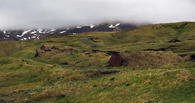 |
| Bomb storage bunkers on Bomb Storage Road |
 |
| Fire hydrants are scattered here and there |
We also visited the so called Adak National Forest. There are literally no other trees on Adak so this little clump of trees is special. They were planted in 1943-45 by the Army as a morale booster. (Note: According to a comment I received in April 2016 from Louie Larson the trees were planted as a memorial for three lost fliers. See his comment below.) Only about 30 trees remain at the present date.
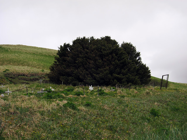 |
| Adak National Forest |
Right next to the "forest" is the Adak Pet Cemetery. It appears that most of the pets buried there were Christians.
 |
We love you, Bandit,
We miss you |
|
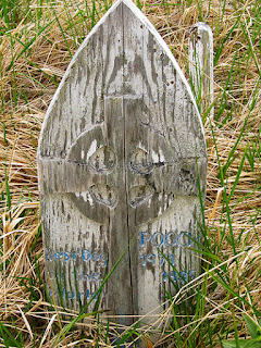 |
Pooch (1970-1985)
Best Dog in the World |
|
|
 |
Fritz Maynard (1988-1991)
A Pretty Good Dog |
|
|
|
On the next two days we spent quite a bit of time driving around the northeastern part of the island in the vicinity of Clam Lagoon. Relics of WWII are still plentiful from the barely visible remnants of Albert E. Mitchell Field, (it's in the shape of a flattened X centered near the tip of the airplane icon below), to the gun emplacements in the hills behind Zeto Point. From the ground, you can barely discern the airfield now — we drove over the runway twice before realizing it — but Google Earth reveals faint outlines of the earthen berms that parallel the runways. It was built in just a few weeks in 1942 for use as a forward base supporting bombers, B-17s and B-24s, that flew hundreds of sorties against the Japanese on Attu and Kiska.
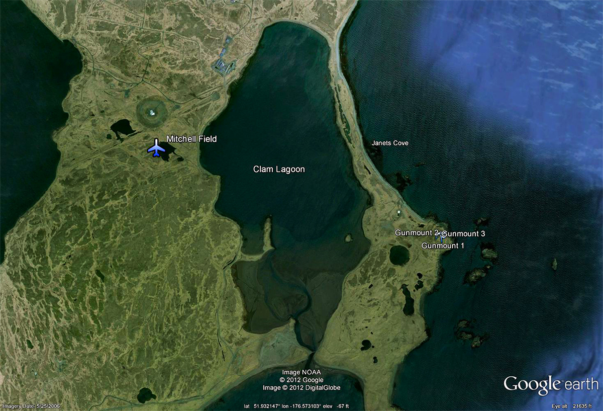 |
| Albert E. Mitchell Field and Clam Lagoon (N51.936274, W176.577220) |
 |
| Mitchell Field is only just visible now due to the berms alongside its runways |
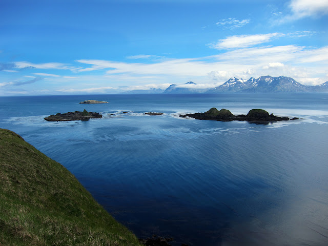
We had two nice afternoons for exploring. And then the last day was almost perfect with blue-bird skies and an ocean that looked positively tropical. We started with a visit to Jean Lake and spent a few hours just hanging out in the hills overlooking Janets Cove exploring the old coastal artillery gun emplacements and enjoying the sun and sky. The Adak landscape, shrouded in clouds and mist for much of the time, revealed its true beauty that day.
 |
| Jean Lake (foreground) and Andrew Lake (N51.917088, W176.637126) |
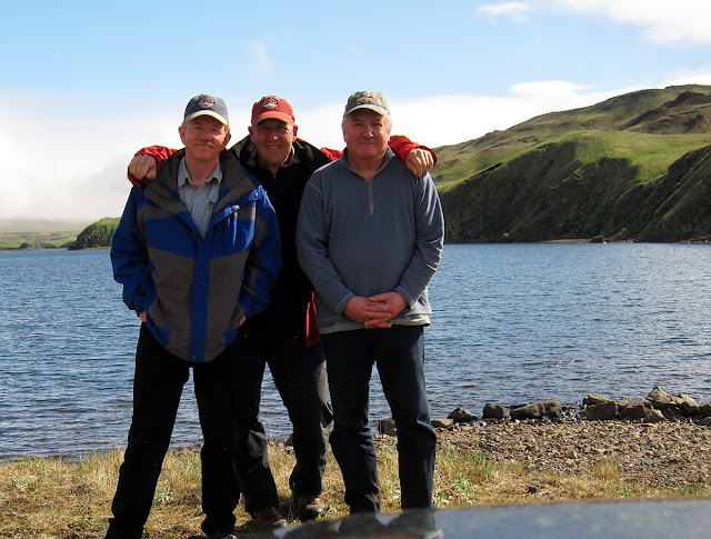 |
| Doug, Dave and Bill at Andrew Lake, June 24, 2012 |
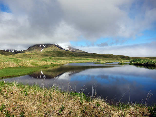 |
| Small pond near Andrew Lake |
.jpg) |
| View to the northeast from the gunmounts |
 |
| View southeast from the gunmounts |
|
 |
| Small halibut long-liner near a big hillside - a view across Janet's Cove (click image to enlarge) |
.jpg) |
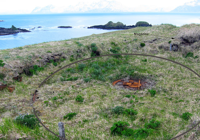
| Gun emplacement (N51.92792 W176.54729) |
I wanted to show the construction of these gun emplacements so I Photoshopped a circle to illustrate the iron track, only a tiny portion of which is visible in the photo, that supported the barrel. The base of the gun was attached to the rotating center piece that was in turn attached to a concrete slab, a so called "Panama Mount". These were big guns that used a 155 mm (6 inch diameter) shell that had a range of 17 miles. They were put there to guard and protect Kuluk Bay and Adak Harbor to the south when there was still fear that the Japanese would try to push through to the mainland of the U.S. after the Pearl Harbor attack and the capture of Attu and Kiska.
All the while we were on Adak Mt. Moffett, the islands tallest peak at 4,000 feet, was hidden in a swirl of clouds and fog. But finally, on this our last day, it emerged white and resplendent.
.jpg) |
| View of Mt. Moffett from the east |
My ideas about Adak and the other Aleutian Islands were changed drastically as a result of our visit. These islands are big, mountainous and beautiful. The country is treeless and owing to the gray misty climate, seems at times stark and barren. But when the sun shines it reveals itself as a gorgeously lush and beautiful land.
Nevertheless, we were happy to head back to Homer after our brief visit. Aside from the exploring and bird watching — we spotted most of the common bird species found on Adak: grey crowned ruby finches, a snow bunting, song sparrows, black oystercatchers, Aleutian terns, and bald eagles — there wasn't much else going on in Adak. There is one store, one restaurant, one liquor store, and one bar which also serves food. Everything in them is expensive (a $9 bottle of wine set us back 30 bucks, a can of evaporated milk was nearly $5) and the choices very limited. Here is a photo of the Bay Five restaurant. It's not much to look at but the Mexican style food was good and the staff friendly. None of the places mentioned above sport any signs. You just have to find them on your own.
 |
| The Bay 5 |
(Note August 2015: There was one other bar/restaurant we visited that I didn't talk about here because its cigarette smoke laden interior put us off but several readers have mentioned it. And a recent reader recommends the Bluebird Cafe, which we didn't happen to notice. See the comments at the end of this post.)
 |
| Doug at Bay 5 |
|
 |
| Bill at Bay 5 |
|
|
 |
| The neighborhood where we stayed. Most of these U.S. government built houses are deserted now. |
We received a message from Alaska Airlines on Monday advising us that our return flight was to be either late or canceled. We panicked at the thought of being forced to spend another 4 days on the island because there are only 2 flights per week. In the end, our flight was merely delayed and I'm happy to say it was back to the Big City for us.
On the return flight, I read an article, "Decontaminating Alaska", mentioning Adak in the June 2012 issue of Alaska Business Monthly I found in the seatback on the 737. As a boy I read everything I could get my hands on about WWII and thought of it as glamorous, a "good war" — it was the war my father and uncle Bill fought in after all. The truth about war, that war and all wars, only came later as I gained years and knowledge. The article fleshed out the role the U.S. armed forces played in Adak during that war. "The U.S. Navy evacuated the residents (the native Aleuts) forcibly to internment camps where many died, and burned the villages to the ground to prevent any use by the invading Japanese army..." The article goes on to describe efforts to remediate the thousands of acres of dumps, buried landfills, unexploded ordinance, asbestos, and who knows what else the Navy left behind. Although the internment of Japanese-Americans is well documented I never knew about the internment of the native Aleuts. Another shameful page in American history.
So ended our Adak adventure. Before we left I had thought of this trip as a once in a lifetime opportunity to see a remote corner of our beautiful state. It certainly met and surpassed all expectations.
Extras:
Article about a recent storm 2015


.jpg)


.jpg)
.jpg)


