Thursday, May 12, 2016

Bicycling in Germany

I just returned from another bicycle tour in Europe and a visit to Iceland. (I'll cover the Iceland visit in another post.) The bike tour took us along the Moselle and Saar Rivers in Germany. And this time my son Tuli joined me making the trip an extra special occasion. We met at the Frankfurt Airport on April 26th and hopped on a train to Saarbrucken where the journey began on the following day. As before I had booked a fully catered tour (bikes, meals and hotel accommodations) through Eurobike, the Austria based company that arranged my Danube ride a couple of years ago. Because this tour was in Germany they handed it off to their German partner, Velociped, which made the hotel arrangements. As before, everything went off without a hitch. The accommodations were excellent overall, the food, especially the buffet breakfasts, was outstanding and the top quality touring bicycles functioned flawlessly. If you're thinking about making a similar tour, 7 nights in 4-star hotels with breakfasts, expect to pay about $1,000 USD. The tour company shuttled our luggage from hotel to hotel so we needed only carry our rain gear, water and lunch in a (supplied) waterproof pannier bag. Check the website links above for more information.

The one downside to our trip was the weather during our week on the radwegs (bike paths) — it was fairly chilly most days and there were intervals of rain. We had one exceptionally fine day, a couple that started out cold and cloudy but developed into fairly nice days later, and one nasty afternoon of heavy rain that soaked me pretty well. Tuli, who bikes in Eugene, Oregon, had better gear so he didn't get as wet as yours truly. A new lightweight rain jacket is on my list of things to buy this summer.

On the Saar Radweg, day 1- Saarbrucken to Mettlach

Typical section of the Saar Radweg

Tuli, dressed for chilly weather in North Face's finest

Tour boat — Saar River

Hotel Zum Schwan - Mettlach
We had a fairly nice ride to Mattlach although this first section of the bike path ran alongside a busy highway and through the heavily industrialized Saar Valley. Our first day was a 42 mile haul, the longest of this particular tour. We reached Mettlach in good spirits, checked in to our hotel and bought a dinner of pizza, toasted sandwiches and sparkling water from the bakery next door.

The next day dawned chilly and gray. We left the hotel rather late that morning but because this was a short segment, only about 26 miles, we thought we'd best wait for the overcast to dissipate. It didn't so we hesitantly set out for Trier at about 10:30 am.

Start of Day 2 - Tuli and I with Mettlach in the distance
This short portion of the Saar Radweg had a nice gravel surface

Tuli riding the Saar Radweg
We rode to Trier on this day and at about the half way point, transitioned from the Saar to the Moselle River valley. The day's ride was not all that long in miles but in the event not all that comfortable either. As some of you know, I did many training rides in Thailand last month, more than 300 miles worth, to get my body accustomed to a bike saddle. I had hoped to be less bothered by long hours on the trail than I had been on my Danube trip. It turns out the discomfort (sore butt) was not because of inadequate conditioning but because the saddles the bikes come with are, in some way, no good. I know that because Tuli is very used to riding, putting in 10-15 miles a day during his commutes to work, so I reasoned that if his butt was sore after only 65 miles of biking, the source of my discomfort must lie elsewhere. I suspect it's because the saddle shape, which looks like the wider seats found on ladies' bikes of long ago, are too wide for someone used to modern day (narrow) men's saddles. But whatever it is, the result was that both of us had sore tails at the end of the day. My strong recommendation to others, and my commitment to myself if I ever do one of these tours again, is to bring along a saddle I'm used to riding on and swap them before the ride.

The next day brought rain. We could see it coming but on a tour like this, one doesn't have the option to wait for better weather. Your next hotel has already been booked and paid for as have all the others after that one. You simply must get to that hotel, rain or shine.

Rain ahead on the trail to Piesport - Moselle River

In Piesport it rained steadily all night and into the morning so we once again were forced to start later than normal. We waited until we were sure the rain was finished before leaving the hotel at around eleven o'clock. The forecast was encouraging and sure enough, by the time we drove the 26 miles to Traben, got settled into our lovely hotel, the Weingut Trossen, the sun came out for a few photo opps before we sat down to dinner.

We were in the heart of the Moselle wine region now and the river valleys, literally every square foot of them, are covered with vineyards, vineyards that have been there since Roman times. Yesterday's hotel in Piesport, the Weingut Lehnert-Viet, and the Weingut Trossen, are both working wineries that have had accommodations added on. (weingut means winery in German). Wine was plentiful, cheap, and I'm sure, quite tasty. Alas, I did not imbibe because my appetite for alcohol, as for so many other things, knows no bounds. I quit drinking alcohol years ago so it's simply better for me to try to ignore the aggravating fact that although I'm traveling in Germany, the home of one of my favorite wines, the beloved Gewürztraminer, I'm unable to sample any of it.

Views from our hotel, the Weingut Trossen


No wine for me at the Weingut Trossen but happy nonetheless
The next day was by far the best of the trip. Beautiful sunshine and warm temperatures graced the entire day. We stopped often to bask in the warmth and watch the river sliding slowly by. The hills and vineyards shimmered in the sun and the Moselle Radweg provided many opportunities for rest stops.

Morning vineyard with grape harvesting machinery

Every possible square foot is used to grow grapes
Tuli rides the Moselle Radweg


These nice benches begged for a tryout
Reichsburg Castle - Cochem, Germany
We arrived at our hotel, the Karl Müller, at about 5:30 and had plenty of time for a walk around the charming town of Cochem.

The next morning was cloudy with rain threatening. The path ran close by a highway for much of the way to Koblenz making this segment seem somewhat disappointing compared to the wonderful ride we'd enjoyed the day before. And then the weather deteriorated. We searched for shelter as the first few drops of rain spattered the pavement and blundered into an older hotel, the Lellman, where we had coffee and apple strudel as we watched the rain pound down outside. Luckily, it soon quit and we were able to proceed under partly sunny skies to our last stop, Koblenz.

We had biked a total of 195 miles (314 km) in six days of easy riding, rainy days excepted. Our Moselle bike trip was over.

On the trail to Koblenz


Wednesday, April 20, 2016

Bicycling Fitness Campaign

If you had told me last year that I'd be bicycling in Chiang Mai, in the summer, in the heat, I'd have said you were crazy. No way was I ever gonna get on a pedal bike for enjoyment in the tropics. But I have. And I'm loving it.

There is a practical reason for my change of heart. I'm meeting my son Tuli in Germany next week where we will do a bike tour along the Saar and Moselle Rivers. I had a lovely time on a ride along the Danube a couple of years ago and was keen to do another. Tuli was available and interested so we decided to do it together. He lives in Eugene, Oregon, and bikes to work every day. In fact, he bikes everywhere. I, on the other hand, after years of fairly intense bicycling had all but given it up. The heat, my age, wah, wah. When I did the Danube tour I was fine for the first few days but after that my body began to complain. Well, not my body so much. It was my butt that hurt and it hurt enough to make the last two days of that splendid trip kind of painful. I was determined to get in shape before this ride and as I know too well the only way to prevent a sore butt is to condition it with riding. Luckily the place Nut and I moved to last month has tons of lockable storage so when my Homer friend Walt Bovich was about to leave Thailand I offered to store his bike. Of course, part of the deal was that I would be able to use it for some training. Now, after many miles of pedaling I'm confident I won't experience the same issues as last time.

Our rental in Ban Chang Kham
The neighborhood we're in is just south of Chiang Mai proper. This area was once the capital of the ancient Lanna Kingdom (Wiang Kum Kam, Wikipedia) and it's loaded with ruins dating from the 12th century. The capital was moved to Chiang Mai, where it's known as the "old city" inside the moat, to avoid the constant flooding it suffered from the nearby Ping River. There are something like 75 of these ancient temples scattered here and there in a two-mile radius. It's a very cool neighborhood. Our rental is a 3-bedroom, 2-bath home that costs 8,000 baht per month (about $220 USD), so it's significantly cheaper than our last place.

Nearby ruins of Wat Pupia (N18.74971° E98.99772°)
Just south of Wiang Kum Kam is peaceful farm country where the lanes are lined with orchards and rice fields. It's dotted with small hamlets, laced with canals and it's very flat. Walter's bike is a nice 18-speed Trek mountain bike with hydraulic fork and knobby tires. The roads and terrain where I ride don't require the knobbies and could be done without the gears for that matter because I seldom need to shift because there are no hills. The small lanes have light traffic and are a pleasure to drive. I had been thinking my riding would take place in Wiang Kum Kam itself because it's so quiet and visually interesting. But after my first few outings of 5 or 6 miles length I began wanting to see more and ride longer. I began expanding my radius to include new territory. Now I'll typically ride for an hour or two and travel 15 or 20 miles. Out of that total there is only a mile or so where I'm forced to use a bigger, busier road so it's a very pleasant way to get some exercise. I leave the house at 6:30 am when it's still relatively cool and traffic almost non existent. "Relatively cool" in Chiang Mai this summer means about 80 degrees — by afternoon the temps have been reaching 105-106 degrees! Whether that's because of El Nino or global warming I don't know but it's been brutal. I stay inside with the a/c on all afternoon. At any rate, the morning rides that started out being purely a training endeavor are now something I very much look forward to.

Typical road on the morning tour — a single lane of smooth pavement

Walt's Trek with my GPS mounted on the handlebars

A fishing pond on the wayside
Rice fields and my ride


Typical weed-choked canal - Ban San Pa Duea

Quiet path on the McKean Hospital grounds, Ban Pa Daet
Since starting this little fitness campaign I've logged about 280 miles on the bike so I should be in reasonably good condition for the ride. After biking from Saarbrucken to Koblenz on the river tour we'll take a train to Amsterdam, where bikers rule the roads. We'll spend a few more days riding around seeing the sights, checking out a few "coffee shops" along the way where we'll sample some of the odoriferous herbs that are legal there.

After that I fly to Iceland where I rented an AirBnB flat and a car for a few days. I'll drive around the area near Reykjavík seeing what there is to see before finally hitting the east coast of the U.S. and my daughter Carin's home in North Carolina. ETA Homer, May 24th at about 10 pm.

I'm counting down the days until I leave Thailand. Nut and I are going through our usual spells of separation anxiety. She's been cooking my favorite foods and treating me extra special. I'm starting to gather and organize my stuff for the trip ahead. I'll be leaving Chiang Mai on Sunday.


A note about dogs:

The biggest problem with riding a bicycle here, in fact one of the the biggest problems with Thailand, is loose dogs. Thailand is chock full of the mangy critters. Most of them won't bother you but many will chase a bike or a jogger and try to bite. It's scary to think about the possibility of a bite and the rabies shot to follow. Many Thais keep dogs to protect their property — most of those are confined to their yards which are enclosed with walls and gates. But many are allowed to run loose and those that live on small streets that don't see many bikers are especially dangerous. I carry a squirt bottle with vinegar for them and a shot in the face works pretty well. My buddy DC carries a stout bamboo stick that he swears by. Once a dog sees that stick raised, he says it stops them in their tracks. Some of the joggers I see are also "packing bamboo" for the very same reason. I just added a bamboo cane to my riding gear and I'm going to start using household bleach in the squirt bottle.

Walt's Trek equipped for mapping, and dog defense
Update April 22:
I had a chance to test "DC's bamboo hypothesis" on my ride today. Five dogs started running toward me growling with teeth bared. I raised the stick in the air and shouted Mai!, Mai! (Thai for No!) They turned away instantly and slunk back to the side of the road. A couple of them actually had their tails between their legs. The stick works much better than the bottle - I wish I could kill the bastards but for now the bamboo stick will be my preferred weapon.

Tuesday, January 12, 2016

Eating in Chiang Mai

I feel privileged to be able to live in Chiang Mai at this stage of my life. Although it's a big city with an area population of about 1.5 million and represents a challenge for small town folks like myself, it does offer many compensations not the least of which is an awesome array of excellent restaurants and cafes. Many of these places are not well known by tourists and some have menus only in Thai so this post could be helpful for folks coming for a visit who want to sample foods Thais normally eat.

Sometimes I'll tease Nut about moving further north where the weather is cooler, Chiang Rai for instance, but she always looks aghast and shoots back, "But where would we eat in Chiang Rai?" There are some good restaurants in Chiang Rai, sure, but the food choices here are vastly better and more varied. And we're both foodies so this is an important reason to stay where we are.

This post is not about high-end dining. We frequent neighborhood restaurants and a few special street food vendors both here in Nong Hoi and north of us in the city proper. There are certainly many excellent restaurants in town but we like to get a quality meal for between 40-150 baht ($1-5 USD) per person, which is easy in Chiang Mai if you know where to look. Plus, the few times we've spent the big bucks in a fine restaurant the food has been not as good as what can be had from these tiny shops. It helps that Nut can spot a good eatery from a mile away. She's led me to some very fine eating and introduced me to foods I would never have discovered on my own.

I'll start with Nana Bakery right here in Nong Hoi. I adore bread and during my first few years in Thailand searched high and low for good bread. Thais aren't big on bread so a good loaf is hard to find but luckily Chiang Mai has a large expat population and Nana caters to it. The place is a goldmine, always busy, and always expanding. We were able to buy Nana croissants in Mae Sariang last month! They make various artisanal breads, buttery croissants and pastries and, speaking as a former sourdough bread baker, produce the best sourdough bread in Chiang Mai possibly in all of Thailand. They also offer a farang style breakfast for under $2 that's hard to beat for value because along with the eggs and bacon comes a latte or pot of tea and a freshly baked croissant. Nana Bakery is located near the junction of Mahidon Road and the Chiang Mai-Lamphun Road. (N18.75770° E99.00851°  Open Street Map)
Nana Bakery Sourdough Rye - 55 baht ($1.57 USD)

Basic Nana breakfast including latte and croissant - 65 baht ($1.85 USD)
A standby meal for us and for all Thais in general is noodle soup prepared using a meat stock, usually made from pork and pork bones, served with various condiments or seasonings and in many styles. A little background for the uninitiated: rice noodles are known as kuaytiaw (ก๋วยเตี๋ยว) and are eaten for breakfast, lunch and dinner all over Thailand. Every town and hamlet no matter how small has a least one noodle shop. Noodles are always served with a quartet of condiments, kruang bprung (เครื่องปรุง), for seasoning: nam pla or fish sauce for adding saltiness; sliced mild chilies in vinegar for sourness; sugar to counter that sourness; and hot chilis either powdered or in an oil paste to add heat. The whole idea here is to add enough of each ingredient to balance the flavor to your liking. I've know for a fact I've gotten good at this, especially at balancing the sour and sweet, because surprise, surprise, Nut will often ask me to season her kuaytiaw.

Our favorite place to eat noodles is at Malee Noodles. They have four shops scattered around Chiang Mai but there's one right up the street from us at the 89 Plaza so Nut and I eat lunch there at least three times a week. Their Sukhothai tom-yum style noodles are fantastic. Malee at 89 Plaza is at (N18.75203° E99.00875°), and here on Open Street Map). Another location more convenient for tourists is in the old city on Arak Road just inside and adjacent to the moat, here (N18.7900387, E98.978457) and shown on Open Street Map. For more info about noodles see the links at the bottom of this post under Extras. They're open from 8 am until about 4 so it's not a spot for dinner.
Malee Sukhothai style kuaytiaw - 40 baht
Another favorite is Wang Sing Kam where you can find one of the best bowls of kuaytiaw pet (ก๋วยเตี๋ยวเป็ด), or duck noodle soup, in Chiang Mai. Along with the soup we often take a plate of grilled duck, pet yang, served with a lovely gravy, sliced ginger and dipping sauce. Wang Sing is near the intersection of Charoenrat and Kaewnawarat Roads here, (N18.79451° E99.00080°) and on Open Street Map. In addition to the kuaytiaw they serve dim sum among other things and iced herbal tea is free. Again, this is a daytime only venue - they close in late afternoon.

Wang Sing duck noodles
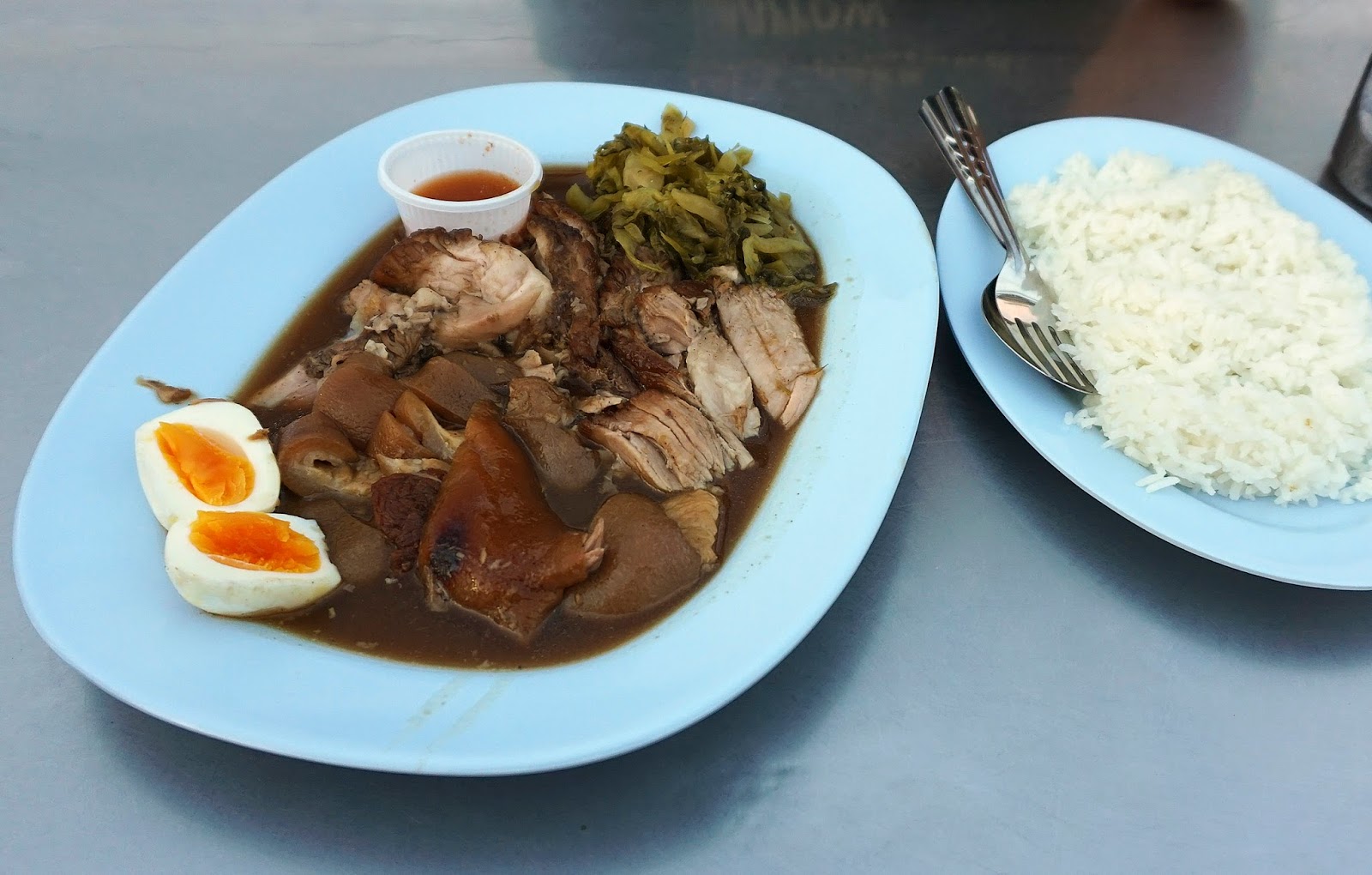
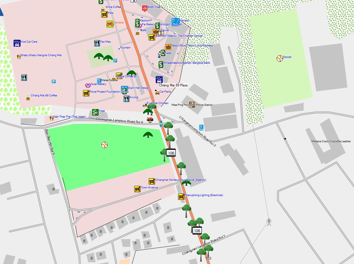
Another Thai standby, especially in the northern provinces, is khao kha moo or stewed pork leg on rice (ข้าวขาหมู). Nut introduced me to khao kha moo when we lived in Bangkok and I'm here to tell you it's one of my favorite Thai foods. Whole fresh pork legs (kha moo) stewed until fork-tender in a rich seasoned gravy, served with rice, soft boiled egg and pickled greens — it's one of the tastiest meat dishes I've ever eaten. And the best place to eat it that we've found is at a tiny open air food stand in our old neighborhood near the Chang Phuak Gate. The gal who serves it is cute as hell in her trademark cowboy hat and she's also the owner of Chang Phuak Khao Kha Moo. When my son Tuli was here a few years ago we took him to all our favorite restaurants and when I asked him later which was his favorite he told me it was "the place we ate that stewed pork".

I have another little story about this shop. We had some visitors from Homer last year, Amon and Laryssa, and we brought them here for dinner one evening. I was going on, as I tend to do, about the great food we were about to eat and Amon says, "We saw an Anthony Bourdain show about eating in Chiang Mai and this place was on it." On that show, he told me, the cowgirl chef revealed the secret of her gravy. "It's the same gravy we started with. We just add more pork leg and seasonings every morning." Truth or fiction? I dunno, but the gravy is awesome.  I spent a couple of weeks in Udon Thani last spring and tried the khao kha moo at a few shops. It was just terrible! Once you've eaten here there's nowhere to go but downhill. Located on Maninopharat Road just west of Chang Phuak Gate in the Torung Chang Phuak Market, (N18.79588° E98.98549°Open Street Map ), it's open from 5 pm until 2 am daily. If you want to get some just head to the night market near the Chang Phuak Gate on the north side of the moat and look for throngs of people mobbing a certain little food cart. That's the place!

Chang Phuak Khao Kha Moo for two, with boiled egg and pickled greens (50 baht, $1.40 USD)
The justifiably famous lady I call the "Cowgirl" serves up some of the best food in Chiang Mai
The little market area we're exploring here, generically known as a night market, can be found in all but the smallest Thai towns. During the day there's nothing much here to suggest what's to come — it's just a wide sidewalk. Then at around 3 or 4 in the afternoon the food vendors start arriving to transform the area. They bring everything they'll need for the evening on motorcycle pulled carts; dishes, cooking pots, stoves and propane bottles, vegetables, ice chests full of meats and seafood, eggs, the whole shebang.  The Cowgirl sells five giant pots of pork legs per day and it must all be hauled to and from the market each day. Most night markets have a dozen or more food shops, as does this one, so a wide variety of fare is available usually for about a dollar a serving.

Google Streetview Thalat Torung Chang Phuak
Another tiny shop we like also in this market is one that sells suki (สุกี้) and kuaytiaw. Nut's tried the kuaytiaw but I always order the suki because it's top notch. Thai suki is only distantly related to the similarly named Japanese sukiyaki and can be found all over northern Thailand. It's a dish composed of rice noodles, chinese cabbage, shrimp, chicken or pork, and egg, gently stir-fried and served with a spicy red sauce. As with so many foods, the secret's in the sauce and this shop has the best. The suki itself is easy to make, Nut's done it plenty of times at home, but we can't seem to capture the flavor of this red sauce either with her own sauce or any we've found in the supermarkets. Thai suki comes in several variations. I like the "dry" style, that is, without any soup stock. This is known as suki hang (hang means dry in Thai). There is also suki nam which is served with some sort of stock to make a soup. I like the suki hang goong, which is dry-style suki with shrimp, pictured below. Yumm!

Suki hang goong-  40 baht ( $1.15)
Chang Phuak Suki Shop - just a few steps west of the Khao Kha Moo Shop
(N18.79588° E98.98536°)
Another favorite streetside shop is located inside the moat on the south side of the old city on Bamrung Buri Road near its eastern end. It's only a short walk from Thapae Gate but most tourists don't know about it. I often see tourists walk past and glance around looking for other farangs I suppose, and not seeing any, pass on by. Knowing how good the food here is, I find myself wanting to invite them in for a great meal. I haven't done it yet but someday...

Like so many others in the night market category, the kitchen is set up each afternoon in front of a Michelin tire store after it closes. In fact, Nut noticed that the cooks also work in the tire store during the day. I love fried oysters the way the Thais do it. Known as hoi tod (หอยทอด) I first had them in Bangkok. I could eat them every day except they're fried in oil and are much too rich to eat very often. This shop doesn't really have a name and the menu is unfortunately only available in Thai so you'll have to ask for your food by gesture or some other way. Hoi tod is something that I've tried at other shops but usually with disappointing results.

Google Streetview - east end of Bamrung Buri Road

Fried oyster plate
The only photo I have shows a plate of hoi tod partially eaten. Sorry about that. The oysters, plenty of oysters, are mixed with a batter of some sort, containing egg and perhaps rice flour, and then tossed into a skillet to be cooked. The finished product is served piping hot on a bed of bean sprouts. This is also eaten with a spicy red sauce, different from the suki sauce I bragged about earlier, but just as important for full enjoyment of the dish. They serve other foods here and Nut has sampled their curried pork and vegetables and a few other items, suki for example, but I always take the hoi tod as it's one of those things I love and just can't get anywhere else. They open at 5:30 pm on weekdays and are located at (N18.78149° E98.99096°) and as described above.

I'll close this edition of Eating in Chiang Mai with a visit to the lovely Sala Cafe. This is a place I discovered on one of my many mapping excursions in the rural town of Mae Rim just north of the big city. The gardens surrounding the cafe are simply gorgeous and there are tables scattered here and there among them. Sala Cafe is located on a small, out of the way rural road. How people find it is beyond me but in the four years we've been coming it has grown increasingly popular.

Cafe Sala entrance 


Garden salad with sliced roast pork, latte
This cafe is a bit more expensive than the street vendors mentioned above yet, if you're used to stateside prices, still a bargain. The lunch above cost 140 baht, a little more than $3.50 USD. They have excellent pastries and the coffee is top notch too. I wanted to include it here to make a point I'll expand on in future posts; there is no shortage of quaint, charming cafes and coffee shops in this part of the world. Being in the tropics means beautiful plants are easy to grow and the Thais have a knack for using them to create elegant cafe environments complete with waterfalls, fountains and fish ponds. Even the coffee shop chains like Cafe Amazon that adjoin gas stations along Thailand's major highways have fountains and gardens to screen one from the hustle and bustle of the nearby traffic.

Sala Cafe is in Mae Rim at N18.90453° E98.92189° near the ritzy Four Seasons Resort. See it on OpenStreetMap here or on Google Maps here. They're open daily from 8 am to 6 pm.

Sala Cafe mango cheesecake and a divine latte
Stay tuned. I want to do more posts about Thai restaurants. I find that doing "research" about restaurants and food is some of the most enjoyable work I've ever done.

Thanks for reading.

Extras:

My earlier story about Eating in Chiang Mai was posted back in 2012 before I got so involved with Open Street Map that I quit blogging and stopped doing almost everything else too.

Nana Bakery has a branch on Chiang Khian Road here (N18.8121189, E98.9579347) but I don't think they serve food there.

Here is a complete and well-written guide to noodle dishes many of which we enjoy often. It explains what Sukhothai and tom-yum style noodles are all about and much, much more.

Part of a blog about Thai food explains in depth the 4-part condiment set, kruang bprung, for seasoning kuaytiaw, here.

Friday, December 18, 2015

Winter comes to Thailand

At long last it's here.

I've been waiting for the cold weather to arrive since August. This past summer was insufferably hot and lasted way too long. A Thailand winter is quite a bit friendlier than those in my home state of Alaska, very subtle, and that's why I appreciate it so much. Some signs of what Thais unwittingly call the cold season are: I can leave butter out on the table without it melting; the honey is difficult to squeeze into my morning tea; I need to wear a jacket outside and slippers in the house, and we can unplug and put aside the ever present floor fans for a while. And not to forget, we will be sleeping under blankets for a few weeks. Wonderful.

Motorcycle travel is especially inviting during this season as well because the air is clear and cool and I can dress properly for riding. In the summer heat I just cannot force myself wear heavy, hot, but safe motorcycling gear. I had a plan for a trip in the back of my mind that involved repeating parts of a delightful ride I'd had last spring. I wanted to revisit Mae Sariang at the southwestern corner of the famous Mae Hong Son Loop, where Thailand's Route 108 coming from Hot in the east turns sharply north to Mae Hong Son and Pai. I had only recently "discovered" Mae Sariang and enjoyed it so much I wanted to return and show it to my friends. And I wanted to follow Thailand 1099, first to Omkoi and then to its southern end in the hamlet of Ban Mae Tuen. I wanted to spend a day or two there to explore the general area while gathering data for my mapping addiction. That was the plan I laid out for my traveling buddies, none of whom had ever been anywhere in that region, and they approved it enthusiastically. My inspiration for the Mae Tuen visit came from Nut who, in the end, had childcare duties that we couldn't farm out. So it was only Bruce & Kathleen, expats from Montana, our good neighbor Daniel, and I that set out for points south last Sunday while Nut was forced by circumstances to stay home.

The first part of the MHS Loop and of our ride goes south from Chiang Mai to Hot on the 108— it's a boring run over a big 4-lane highway — but the drive west from Hot to Mae Sariang is a wonderful ride on a motorcycle.  The 2-lane between Hot and Mae Sariang is another of Thailand's many fine motorcycle roads and offers the rider plenty of twisties as it follows the Mae Chaem River while gradually ascending to 3700 feet above sea level at the junction of the 1099, the road we'd be taking for our trek south a couple of days later. The air temperature up there had dropped to a decidedly brisk 65-70 degrees so we took a break to put on our extra jackets.  We'd be returning here later in the trip but for now continued our westerly course. Still ahead was another 30 miles of winding scenic highway cutting through thick pine woods that scent the air with a resinous fragrance that never fails to remind me of the Adirondacks of New York. Eventually the road descends to the Yuan River valley and the little town of Mae Sariang. We rode on a Sunday so traffic was light making our ride through the woods especially sweet.

Rest stop along the 108

Riding the 108

Sunset from the balcony at River Bank GH (N18.16332° E97.93116°)
My plan was to stay somewhere in Ban Mae Tuen but after Googling around for a while and checking the Thailand riders' forums my search for a hotel had turned up nothing. So I decided to make reservations at a little resort I visited last year in the town of Omkoi, which is on the 1099 at roughly the half way point. It was a smart move in the end because we had good accommodations in a beautiful setting — the Omkoi Resort lies in a shady grove alongside the Mae Tuen River — and shortened what would have been in hindsight quite a long ride to a much easier one. We made the 100 mile round trip to Ban Mae Tuen the next day after a tasty meal at the resort and a good night's sleep. Omkoi is 2700 feet above sea level so it experiences morning temperatures of 55-60 degrees. While that may sound balmy to you northern types, keep in mind that no hotel room, or private residence for that matter, in Thailand has heat — we were able to sleep comfortably but we needed the thick comforters our resort hosts provided.

We rode the pine tree lined 1099 into Omkoi

Sunset at Ban Dong Reservoir - Omkoi
Next day we ate khao tom, a traditional Thai breakfast of boiled rice with pork bits and assorted spices, in front of a campfire. Yep, a genuine campfire. We definitely appreciated having a crackling-hot fire to fend off the morning chill. After putting away a big bowl of khao tom and a couple tall cups of coffee we took off. The ride from Omkoi south was unexpectedly delightful. The 1099 north of Omkoi is a sweet ride but this southern leg has it all — it's a smooth road full of curves, sweeping panoramic views, quaint little towns, forests of mixed pine and hardwood, and enough clouds to make dramatic photos — the works!

The 1099 - good pavement, great views

Farm road


Ban Mae Tuen is a sleepy little town and is where the 1099 and the pavement ends. There are several rough tracks through the forested mountains that lead south to the Mae Sot area or west to the 105 from here but those are not something I can deal with on a road bike. There are some Chiang Mai based dirt bike enthusiasts who write reports about back country travel in the region that you can check out here and here if you're interested.

We did not find a place to stay during our brief visit to the town — no resort, guesthouse or home stay accommodations were apparent. However you can always find food anywhere in Thailand. We stopped at a tiny little restaurant (17.4023, 98.4573) that was serving up a tasty gaeng hang lay (recipe), which is one of my favorite Thai dishes, and then for dessert had an iced latte at the tiny Mae Tuen Cafe on the north side of town (17.4054295, 98.4555356). After the latte we saddled up and turned back to Omkoi. Recounting our day over dinner that evening we gushed over our awesome ride on what has got to be one of the prettiest highways in Thailand, the 1099.

The 1099 northbound to Omkoi from Ban Mae Tuen


Extras:

Our equipment: Bruce & Kathleen ride a Honda Forza, a super scooter with 300cc engine, comfy seating for two, and automatic transmission. Danny drives a Honda PCX, a medium size scooter with a 150cc engine and automatic transmission. My bike is a Honda CB500X, a full-size touring motorcycle with a 6-speed manual transmission and 500cc engine.

Trees: The pines we encounter on our jaunts into the high country are probably a variety known as Khaysa or Khasi pine (sp. Pinus kesiya). According to Wikipedia they are native to India and SE Asia and the Royal Thai Forestry Department has planted thousands of them in reforestation projects in Chiang Mai and other northern provinces. Another possible candidate is Caribbean or pitch pine, (sp. Pinus caribaea), which is common in parts of the U.S. and was my first guess as to which species we were seeing. One of the references I located gives the Thai name chuang to the Khaysa pine (my transliteration is: ชวง or ช่วง) but I'm not sure if either is correct. If anybody reading this can help identify this species please leave a comment.


GPX file: Ban Mae Tuen day trip

Click on the file link and select Download from beneath the cleverly hidden "More" menu (those three blue dots), at the top right of the resulting page, browse to a folder or your desktop where you want to place the file and click on the Save button. You can open it with Google Earth or any other application that can display GPX files.

Friday, December 4, 2015

Mapping in Thailand — Trees and other things

I'm so caught up in mapping that it affects everything I do — it's a major force in my life. It's an addiction, an obsession. It also gives me great joy and lends a purpose to my days other than merely wondering how much time I have left on this planet. Unfortunately, at my age one's thoughts tend to turn in that direction all too often. Mapping focuses my thoughts in a much more positive way. I'm learning about something that has fascinated me forever, the visual representation of geographical features on paper or a computer screen. The desire to talk about mapping has now brought me full circle, so to speak, and motivated me to write a long overdue blog post.

I'd rather not divulge, or perhaps confess is a better word, the exact number of hours I spend at the computer on Open Street Map (OSM) projects but most days it's like a fulltime job. I'll sit down at my desk first thing in the morning, usually at about 6 am, with a cup of coffee beside me to check my email and before I know it I'll be adding some details to OSM or planning a moto ride to check out an area I'm curious about but haven't seen in person. I used to write in this blog more often but I just don't seem to have the time anymore. Ridiculous, I know. Those of you still working know how precious personal time is and you might think a retiree has nothing but time on his hands. But between tennis, a relationship, motorcycling and mapping I manage to keep myself quite busy all day, every day.

A short while ago I got an email from an OSM mapper in Belgium. He asked if he could interview me for a "Mapper in the Spotlight" series started by the OSM Community in Belgium a couple of years ago, the idea being to get to know one another so as to become more of a community. He only knows me from some posts I made on OSM's Tagging listserv, which is a mailing list where participants discuss how to tag (or otherwise characterise) mapped objects for the OSM database. I felt honored and responded right away. Marc sent a list of questions that I answered and which he incorporated into his blog. Answering his questions in my own words constituted the "interview" and I suppose that's the best sort of interview one could hope for, i.e., one you write by yourself about yourself. If you want to read it you can find it here.


Yang na trees lining the busy Chiang Mai-Lamphun Road (Nong Hoi)
The tree mapping project I touched on in that interview is what I'm working on lately. Nut and I moved to Nong Hoi last spring. Our new neighborhood is on the south side of Chiang Mai and after discovering the good coffee shops and restaurants nearby, we've come to really like it. I have been fascinated by the magnificent and stately Yang na trees lining the Chiang Mai-Lamphun Highway through Nong Hoi (Route 106) since I first saw them several years ago. Their scientific name is Dipterocarpus alatus and they're related to rubber trees. Thais call them "ton yang na" (ton = tree). These splendid trees have an interesting history. They were planted in 1882 by order of King Rama V when the Chiang Mai-Lamphun road was but an ox cart. Residents living along the track were delegated to care for them by supplying water and fertilizer. You can read more about how they came to be in this short article. The shade they provide on the now very busy thoroughfare is wonderfully cool and reminds me of the elm tree "tunnels" that once adorned most of the streets in my hometown of Buffalo, NY. Buffalo's elm trees are long gone, killed by the Dutch Elm Disease that ravaged the U.S. back in the 70s. These trees might disappear someday as well but for a different reason: traffic and pavement have stifled their growth and made them vulnerable to disease. Dipterocarpus alatus is now considered an endangered species in its original habitat (see this Wikipedia article), and many of the Nong Hoi trees are either gone or in poor health. You can tell by the ribbons of gold cloth tied around each trunk that the Thai people revere them. Yet despite that concern pavement continues to encroach and their overall health continues to decline.

Yang na trees - morning - Nong Hoi
A healthy, open grown Yang na - Nong Hoi

I'm planning to enter data for each local Yang na tree into OSM. I will locate them positionally by using a combination of GPS data and spatial observations from the ground. Almost every tree has a tag with a number on it. I'm not sure which Thai government agency maintains these records, or if any do, but I'll enter that number in the ref tag when available. I measured the height of some of the ones closest to my home using an iPhone app called Theodolite which does the same thing as the theodolite instrument used by surveyors, which is to measure angles. It's not nearly as accurate as those precision instruments but is, as we say, "close enough for guv'mnt work" and just the ticket for my needs.

Theodolite (v5.0) screen on iPhone 5
In practice you can use simple trigonometry to calculate the height of the side of a right triangle given the length of one side and the angle between them. The trick is in measuring the angle. Theodolite makes that easy. I paced off a distance from the base of a tree and then sighted back toward it using the crosshair to mark A and B readings at its base and top; Theodolite then calculates a height. Since all these trees were planted at the same time most are roughly the same height, which is about 40-45 meters (~150 feet). It's not my goal to measure the height of each and every one of perhaps a hundred trees still standing but over the next few months maybe I'll get most of them positioned.

I've created a helper tool to make entering this information into OSM easier. JOSM is the most powerful editing program available for working with OSM and it's the one I use. It allows one to develop shortcuts called presets that facilitate entering data speedily, and consistently. Here's the one I'm using for the Yang na trees:

<item name="Tree: Yang na" type="node">
          <label text="Tag a Yang na tree node"/>
          <space />
          <key key="natural" value="tree" />
          <key key="leaf_type" value="broadleaved" />
          <key key="leaf_cycle" value="evergreen" />
          <key key="species" value="Dipterocarpus alatus" />
          <key key="species:en" value="Yang na" />
          <key key="species:th" value="ยางนา" />
          <key key="species:wikidata" value="Q140957" />
          <key key="wikipedia"  value="en:Dipterocarpus_alatus" />
          <space />
          <text key="height" text="Height (m)" default="" delete_if_empty="true"  />
          <text key="circumference" text="Trunk Circ. (m)" default="" delete_if_empty="true"  />
          <text key="height_trunk" text="Bole Height (m)" default="" delete_if_empty="true"  />
          <text key="diameter_crown" text="Crown Diam. (m)" default="" delete_if_empty="true"  />
          <text key="ref" text="Ref #" default="" delete_if_empty="true"  />
          <space />
          <text key="note" text="Note" default="" delete_if_empty="true"  />
          <space />
          <text key="name" text="Name" default="" delete_if_empty="true"  />
          <text key="name:en" text="Name:en" default="" delete_if_empty="true"  />
          <text key="name:th" text="Name:th" default="" delete_if_empty="true"  />
</item>

Using a preset makes it easy to remember exactly which tags are necessary to fully characterize the trees; it includes the scientific or Latin name, common names in both Thai and English along with the physical measurement data and saves me having to enter each tag manually. I've included tags with links to a Wikipedia article and the Wikidata entry. The code above produces the dialog box at the left (see below). After filling in the physical data and clicking Apply Preset, JOSM's Tags/Memberships Window (on the right) shows the relevant tags which are now ready to be saved and uploaded.

Applying the Yang na preset in JOSM
Another part of the project that is of primary importance to me is that I want to see "my trees" on a map. Someday OSM will be available in 3D and then the heights and crown diameters I'm entering will be used by rendering software to create pretty visual representations of them. But I don't want to wait for that to happen. The map you see on the main OSM page for this area has little icons for many common POIs (Points Of Interest): restaurants, hotels, bus stops, traffic signals, but doesn't show some of my favorite mappable items: trees, milestones, towers, and motorcycle fueling stations, to name only a few. (See my previous post Mapping in Thailand for more about my milestone fetish.)

That's why I began creating my own map icons that will display on my Garmin GPS and in Garmin's Basecamp program. For me, seeing the POIs I've entered on a map is one major payoff for the work I've done entering the data in the first place. I can also customise the colors and appearance of highways, woods and landuse polygons, and decide which POIs I want to see. I might not be interested in seeing hairdressing shops or veterinary offices visually but I definitely want to know if there is a nearby shop selling motorcycle fuel by the liter if I run low while riding out in the boonies. These small "bike petrol" shops are very common in rural Thailand where motorcycle travel is the norm.

Fuel stations suitable for motorcycles. A "Drummed Fuel" station and a vending-machine fuel station

In fact, distinguishing a small shop selling fuel hand-pumped out of a large drum from normal full-service fuel stations was one of my main motivations for making my own maps and customizing them for my needs. To the OSM community both are "amenities", places to buy motor fuel. But personally I would not want to drive to a place that's hand pumping fuel by the liter if I need a tank of fuel for an SUV. I designed a unique icon for my GPS that enables me to tell at a glance which type of fuel station it is.

Another type of fuel station that's become increasingly common in rural Thailand are vending machines that accept paper currency in exchange for a metered quantity of fuel. I'm betting these shops will eventually replace the drummed fuel shops. I made an icon for those too, one of which is visible at upper right in the above Garmin Basecamp screenshot.

Getting back to trees, I've designed some icons to represent them as well. They need tweaking but they'll do for now. My plan is to use several different sized icons to represent trees that are especially broad or tall. Tests can be made during the map compilation process to determine sizes just as species is determined now. Another favorite tree, common here and appreciated because of the shade its huge leafy crown offers, is the Rain tree. Its scientific name is Albizia saman. Thais call it Ton Chamcha (ฉำฉา). This tree has a shape something like an umbrella and they are literally everywhere. I have a preset similar to the one for Yang na that applies a set of tags specific to this tree. I also have presets for teak (Thai: ton sak) and Bodhi or Buddha trees (Thai: ton pho), both are fairly common and both have special significance in SE Asia.

Chamcha tree
Below is a screenshot of an area in my neighborhood where Yang na trees line the Chiang Mai-Lamphun Road. This image is also taken from the Garmin Basecamp program and displays almost identically on the screen of my Garmin Montana GPS receiver mounted on my motorcycle handlebar.

Garmin Montana Screenshot Chiangmai-Lamphun Road - Nong Hoi
I add this last photo just to show that not all trees in my neighborhood are big or magnificent. Here is a shot of the little papaya tree that was only a stick when we moved here last March. In just 9 months it gained substantial height and its trunk is about 5" in diameter. As you can see it also has fruit almost ready for harvest. Nut's excited because she loves papaya and to get them for free is extra special.

Our papaya tree

Stay tuned and thanks for reading.


September 1, 2017: An effort to preserve and protect these wonderful trees is underway. The following short article appeared in Chiang Mai City News today:

Local villagers along the Old Chiang Mai-Lamphun Road are trying to save the century-old yang na trees as they are becoming more and more unhealthy from lack of air and nutrition.
According to Bunchong Somboonchai, head of a tree doctor volunteer group, said that there are about 900 yang na trees along the road and about 340 of them are in critical condition, being strangled by the concrete road, smothered by fumes of heavy traffic and generally living in a bad environment.
On August 30th, locals from A. Saraphi and volunteers gathered at Wat Koo Sua to implement a method invented by Maejo University, with support from Chiang Mai Provincial Office of Natural Resources and Environment. They delivered food and air through perforated PVC pipes filled with fertiliser were used and buried about two metres from the tree’s roots.
Bunchong added that it would take about two years for each tree to recover and to sustainably preserve these historic trees the whole community has to be involved and learn more about how to care for them.

Extras:
I was reading the OSM blog today, Christmas Day, and it contained a note concerning node #1, that is, the OSM object with an id of 1. It turns out that this particular node happens to mark a tree, and in addition that tree happens to grow in Passau, Germany, a town I visited a couple of years ago. It was my debarkation point for a 6-day bicycle trip along the Danube. How's that for coincidence?

The tree is located here: (48.566985, 13.4465242)